Streetcars, buses, ferries, bikes, and your own two feet — here's how to get around New Orleans without renting a car.
Do You Need a Car in New Orleans?
No — you don't need a car in New Orleans. Most visitors get around by streetcar, RTA bus, ferry, bike, and on foot. The neighborhoods travelers spend the most time in — the French Quarter, CBD, Warehouse District, Marigny, and Garden District — are connected by transit or an easy walk. Skipping the rental also means skipping downtown parking, which runs $30–$50 a night at most hotels.
Streetcar lines: St. Charles Avenue Streetcar Line (#12), Canal/Cemeteries Streetcar Line (#47), Canal/City Park Streetcar Line (#48), Riverfront Streetcar Line (#49), Rampart/Loyola/UPT Streetcar Line (#46)
How to Pay: Le Pass app, ticket machines, or exact change
Bike Share: Blue Bikes, stations citywide
Going from the Airport to the French Quarter and Downtown
Hop on the RTA’s 202 Airport Express, a city bus that travels from Louis Armstrong New Orleans International Airport to Downtown New Orleans. The new and improved 202 Airport Express now serves stops on Poydras Street from Loyola Ave. to Convention Center Blvd. The fare is $1.25. When you're at the airport, bus service is available from Level 1 Baggage Claim outside Door 2, Zones B4 and B5. Find more information and plan your trip here.
New Orleans’s streetcar lines have been a staple of public transportation in the city for centuries – more specifically, the St. Charles Avenue streetcar line began toting passengers in 1835, making it the world’s oldest continually operating streetcar line. Nowadays, the iconic brown and green or red and yellow carts follow tracks across the city.
Catch a streetcar on Canal Street to head through downtown, Uptown, and partway down Carrollton Avenue. Get off on at the stop on St. Charles and Jackson Avenues and explore the beautiful architecture of the Garden District’s historic homes before stopping for lunch on Magazine Street.
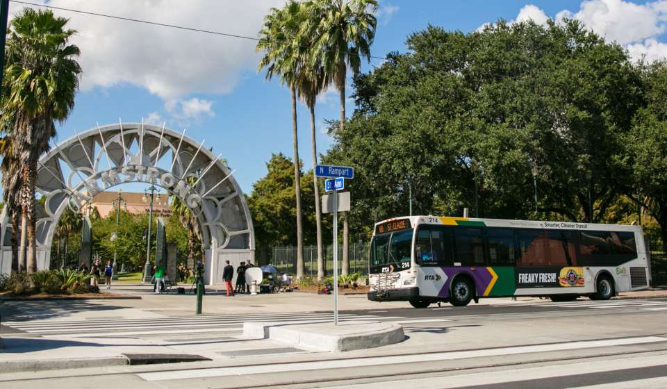
The city bus system is a classic, reliable transportation option, and if you plan on traveling across the Mississippi River, you can always catch a ride on the Algiers Ferry. For a more informational bus experience, the Hop-On Hop-Off Tour buses circulate around some of the more popular tourist areas in the city, offering pick-up every 30 minutes. There are plenty of bus and van tours to choose from that will help you explore the city and surrounding areas with ease!
If you like to feel the wind in your hair and catch the sights and sounds of the city outdoors, there are plenty of bike rental options throughout New Orleans. One of the most universal are the Blue Bikes, a bike share system with stations throughout the city. Use the Lafitte Greenway to bike easily and safely from Mid-City to the Mississippi River.
For a more curated experience, many bike rental companies also offer guided tours through different neighborhoods, showing you a new side to city that you can only get on two wheels. Also, if you’re traveling within Downtown, Warehouse District, and French Quarter areas and the walk is a bit too far between locations, these neighborhoods are full of pedicabs to carry you through the streets with ease.
Once you’ve chosen a neighborhood to spend your day in, traversing on foot is the tried-and-true method of travel. NOLA is full of scenic spots to walk (or jog, if that’s your thing), for both fitness and for fun. It may sound trite, but you’ll be surprised at the things that you might have otherwise missed when you take the time to really walk a neighborhood.
There are walking tours in most neighborhoods on all things uniquely New Orleans. Be sure to dress according to the weather and wear comfy shoes!
Getting around New Orleans by rideshare or taxi is a convenient option for reaching neighborhoods, attractions, restaurants, and nightlife beyond the streetcar and bus routes. Rideshare services such as Uber and Lyft are widely available throughout the city, while taxis can be found at hotels, airports, and other popular destinations. For trips to and from Louis Armstrong New Orleans International Airport, both taxis and rideshare services offer convenient transportation into the city.
Getting Around New Orleans During Major Events: Tips and Tricks
Getting around New Orleans during major events can look a little different than a typical day in the city. Large festivals, parades, and sporting events may bring road closures, increased traffic, parking restrictions, and crowded public transportation. Plan ahead by checking event-specific transportation updates, allowing extra time to reach your destination, and considering public transit, walking, biking, taxis, or rideshare when driving and parking may be challenging. For the smoothest experience, build some flexibility into your schedule and remember that getting there is part of the New Orleans experience.
A single ride on any streetcar or RTA bus is $1.25, and unlimited-ride Jazzy Passes start at $3 for one day. You can buy fares in the RTA's Le Pass app, at ticket vending machines, or with exact change on board. See our full streetcar guide for routes and hours.
How do I get from the airport to the French Quarter without a car?
The RTA's 202 Airport Express bus runs from Louis Armstrong New Orleans International Airport (MSY) to Downtown New Orleans for $1.25, with stops along Poydras Street. Rideshare, taxis, and airport shuttles also serve the airport and drop directly at French Quarter hotels. The ride takes roughly 25–40 minutes depending on traffic.
Is New Orleans a walkable city?
Yes, especially in the French Quarter, Marigny, CBD, and Warehouse District, where most attractions sit within a 20-minute walk of each other. Longer distances — Uptown, Bywater, Mid-City, Tremé — are better covered by streetcar or bus. Sidewalks in historic neighborhoods can be uneven, so comfortable shoes matter more here than in most cities.
What's the cheapest way to get around New Orleans?
A $3 one-day Jazzy Pass covers unlimited rides on RTA buses, streetcars, and ferries — cheaper than a single rideshare trip. For multi-day visits, a 3-day Jazzy Pass ($8) costs less than one day of downtown parking.
How do you get to the Garden District from the French Quarter?
Take the St. Charles Avenue streetcar, the world's oldest continuously operating streetcar line. Board on Canal Street and ride to the Jackson Avenue stop, roughly 20 minutes. From there you're a short walk from the Garden District's historic homes and Magazine Street shopping and dining.
Is New Orleans public transportation wheelchair accessible?
RTA buses and the Canal Street, Riverfront, and Rampart–St. Claude streetcar lines are wheelchair accessible with motorized lifts. The historic green St. Charles Avenue streetcars are not, but accessible buses run the same route. Find our accessibility guide here for more.
How do you get around New Orleans during Mardi Gras?
Many people walk or take transit — parade routes close major streets for hours, streetcar service is suspended along parade corridors, and rideshare pickup zones shift. Driving and parking near a parade route is the hardest way to do Mardi Gras. Check the RTA's Mardi Gras service alerts before you head out. Planning ahead is key.